Lauchernalp to Faldumalp to Ferden 
Distance: 7.1 miles
near Kandersteg in The Bernese Oberland
By: Diane Greer
Cirque at the head of the valley
This hike travels between Lauchernalp and Ferden on a segment of the Lötschentaler Höhenweg . Highlights include grand views of the glacier-clade peak rimming the Lötschental, lovely meadows, pretty villages, and gushing streams
- Distance: 7.1 miles (One Way)
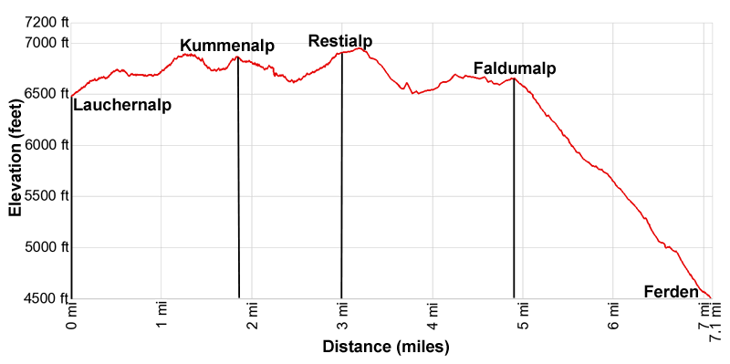
- Elevation: 6,430-ft. at Trailhead
Maximum elevation - 6,950-ft. - Elevation Gain: 520-ft.
- Difficulty: moderate-strenuous
- Basecamp: Kandersteg
- Region: The Bernese Oberland
Trail Description - Lauchernalp to Faldumalp to Ferden
Note: There is a lot of up and down along this hike. The cumulative elevation gain and loss is +1,267-ft./-3,231-ft (+386-meters/-985-meters).
This trail travels along a segment of the Lötschentaler Höhenweg between Lauchernalp and Faldumalp before descending to Ferden. The day starts in Wiler where hikers take the Lauchernalp Bergbahn, a cable car, to Lauchernalp. (See trailhead directions below.) At Lauchernalp exit the cable car station and find the trail signpost. Here signs for the Loetschentaler Höhenweg point west (down valley) to a trail heading toward Hockenalp (15 min), Kummenalp (1hr) and Faldumalp and east (up valley) to a trail toward Weritzalp (50 min) and Fafleralp (2hr 30min). We head west on the trail toward Hockenalp.
The path ascends west through meadows on moderate grades. As you gain elevation enjoy ever-improving views of the peaks rimming the lower end of the Lötschental along with distant views of the high summits towering above the Mattertal to the south.
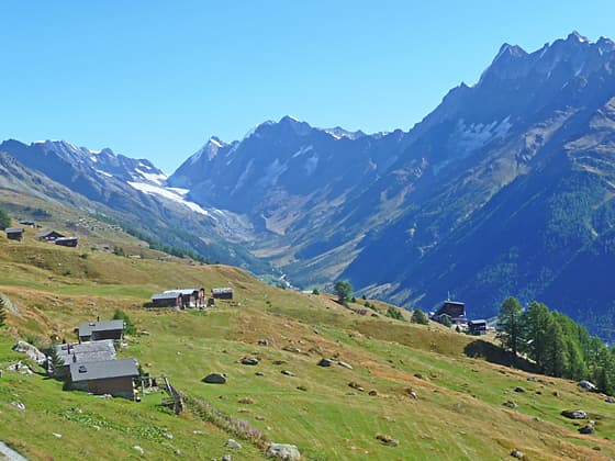
After 0.5 miles (0.8 km) the path reaches Hockenalp and a junction. Here views encompass the Bietschhorn, Breitlauihorn and Breithron towering above the south side of the valley. On a clear day, vistas extend up the valley to the Breithorn, Grosshorn, Sattelhorn and Schinhorn anchoring the cirque at the head of the valley. The Lang and Anun glaciers spill down the slopes of the cirque.
At the junction turn left on the Lötschentaler Höhenweg toward Kummenalp and Faldumalp. The path now travels on easy grades through meadows and soon crosses the Golmbach, a stream draining the slopes beneath the Hockenhorn, looming overhead.
Beyond the crossing the trail ascends and then descends along the steep slopes above the north side of the valley, accompanied by views that stretch down the Lötschental to the high summits towering above the Mattertal to the south. At 1.6 miles (2.6 km) the grade briefly abates as the path passes a junction with a trail dropping down to Kippel along the valley floor.
Past the junction the path climbs to and crosses a bridge over a stream and soon reaches Kummenalp and a trail junction at 1.9 miles (3.1 km). Kummenalp sits upon a shelf along the north side of the tributary valley. The Ferdenhorn and the Balmhorn rim the valley to the northwest. Lötschenpass, a popular crossing between the Valais and the Bernese Oberland, is located on the saddle on the ridge beneath the Balmhorn.
At the junction in Kummenalp two trails branch right. One to Ferdenpass and Leukerbad and the second to Lötschenpass, Selden and Kandersteg. We bear left on the continuation of the Lötschentaler Höhenweg toward Restialp and Faldumalp.
The path now descends along a broad track beneath the Kummenalp shelf. At 2.2 miles (3.5 km) the trail crosses a bridge over the Fardenbach, a stream draining the tributary valley. Past the bridge the path curves to the left (southeast) as it continues its descent through meadows and clusters of trees beneath the slopes of the Restigrat (Resti Ridge).
Be sure to turn around for great views of the Ferdenrothorn and the Balmhorn. To the east are fine views of the summits rimming the Lötschental.
At 2.5 miles the trail reaches at junction at Trockene Stiege. Here a broad track branches left and drops down to Ferden. We bear right on the Höhenweg , which curves to the right around the head of the Restigrat, exiting the tributary valley.
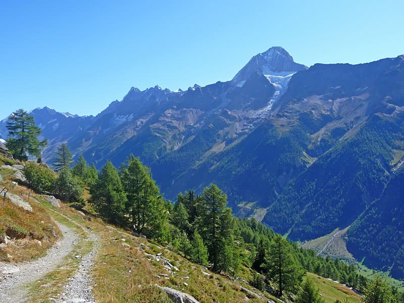
The path now ascends on moderate to moderately-steep grades as it enters a second tributary valley. Ahead are more good views of the peaks to the south. Behind you are the jagged summits towering above the south side of the Lötschental. As you approach Restialp views open to the Restirothorn and the Loicherspitza rising above the head of the valley.
At 3.0 mile (4.8 km) the track reaches Restialp, a small village, and a trail junction. Turn around here for more great views up the length of the Lötschental.
At the junction a trail branches left, dropping steeply down to Ferden. This path can be used to shorten the hike if the weather is taking a turn for the worse. Otherwise, continue straight ahead on the Höhenweg toward Faldumalp. The path quickly passes a second junction with a trail bearing right to Restipass, a saddle on the ridge between the Restirothorn and the Loicherspitza.
Beyond the village the trail to Faldumalp briefly traverses the north slopes of the tributary valley before descending on moderate to moderately-steep grades to cross the Dornbach, the stream draining the valley, at 3.5 miles (5.6 km).
Beyond the crossing the trail continues its descent though meadows and clusters of trees beneath the slopes of the Faldumgrat (Faldum Ridge). At 3.8 miles (6.1 km) the grade abates as the path curve around the head of the Faldumgrat and enters a third tributary valley.
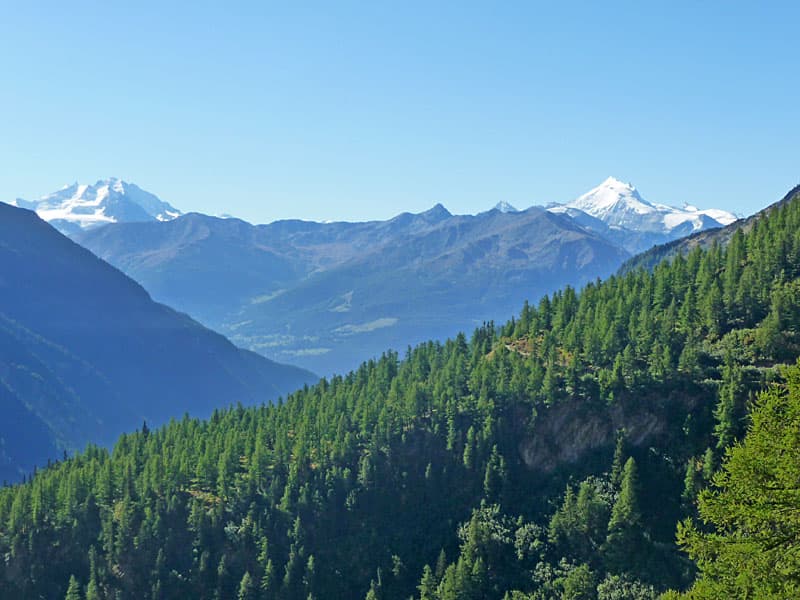
The narrow trail now follows an undulating course beneath the northern slopes of the Faldumgrat. Along the way a few short, slightly exposed sections of the path are secured with fixed cables. Openings offer fine views of Faldumalp and the distant, ice-clad peaks of the Mischabel Range rising to the south. Turn around for panoramic views up the length of the Lötschental.
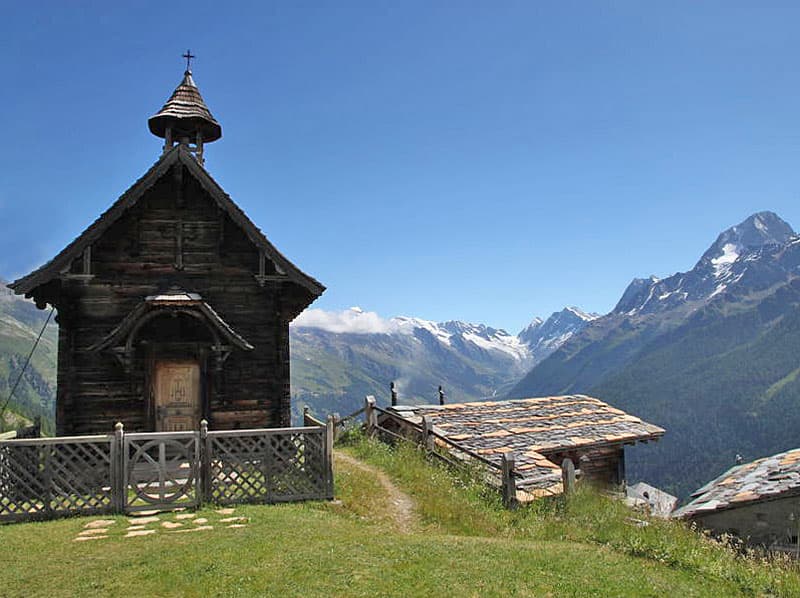
Near Faldumalp the trail descends to a junction at 4.8 miles (7.7 km). Here a trail branches left to Ferden. We will use the trail on the final leg of the hike. For now, continue along the Höhenweg that crosses a bridge over the Faldumbach and ascends to Faldumalp at 4.9 miles (7.9 km). The village, with its pretty wood chapel, is set atop an overlook with stunning views up the length of the Lötschental. The Faldumrothorn rises to the west.
After visiting the chapel and taking in the views, retrace your steps, descending to and crossing the bridge over the Faldumbach. Reach the trail junction beyond the bridge at 5.1 miles (8.2 km) and bear right on the trail to Ferden.
The path descends steeply through meadows along the north side of the Faldumbach and soon enters the trees. In a short distance the path turns right on a switchback and then drops down to and briefly follow the road descending to Ferden. Watch for the signs marking were the trail exits the road and then turns to the left on a switchback. The path now descends north/northeast through trees and intermittent meadows. Openings offer nice views of the summits rimming the Lötschental.
Cross a bridge over a stream at 6.5 miles (10.5 km). At 6.8 miles (10.9 km) the path crosses the road to Ferden, shortcutting long switchback on the road. The trail now drops through trees to a road in the upper section of Ferden. Here we follow the signs to Ferden Post and bus stop by crossing an intersection and then descending a pave road. At the next intersection turn right and drop down a cobblestone lane to the bus stop, located along the main road in the valley, at 7.1 miles (11.4 km). Here buses run down valley to the train station at Goppenstein and up valley to Wiler and Fafleralp.
Elevation Profile
Driving Directions
Note: The shortest and easiest access to this hike is to stay in the Lötschental (Lötschen Valley). The valley is also a fine day trip from many destinations along the main Valais train line from Sion or Brig. Thanks to the Lotschbergtunnel, this hike is also easily reached from Kandersteg in the Bernese Oberland.
From Wiler to Lauchernalp: Walk to the Talstation (Valley Station) for the Lauchernalp Bergbahn (cable car to Lauchernalp) and purchase a one-way ticket. The cable car runs every 30 minutes. Starting and ending times vary by season. Check the timetable on the Loetschental website for current information. The ride takes 5 minutes.
From Kandersteg (Bernese Oberland): From the Kandersteg Bahnhof take the train in the direction of Brig and get off at Goppenstein (about 13 minutes). Find the stairs that lead under the train tracks to the bus stop on the east side of the train station where you should board the bus bound for Fafleralp.
Get off the bus at the Wiler Talstation (Valley Station) for the Lauchernalp Bergbahn (cable car to Lauchernalp). The bus ride takes about 10 minutes. Purchase a one-way ticket. The cable car runs every 30 minutes. Starting and ending times vary by season. Check the timetable on the Loetschental website for current information. The ride takes 5 minutes. There are very good connections between the train and the bus in both directions. Train and bus schedule are available online on the SBB website and the SBB app.
Trail Resources
- Trail Photo Gallery
- Trail Maps
- Basecamp(s) Information: Kandersteg
- Region Information: The Bernese Oberland
- Other Hiking Regions in: Switzerland